


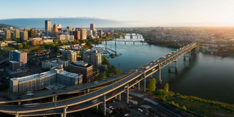




East Portland climate risks are concentrated most sharply near Interstate 205, according to a Portland State University study combining four major hazards on a single map. The peer-reviewed research examines heat, flooding, wildfire and landslide potential, showing where overlapping exposure intersects with infrastructure, environmental conditions and access to critical services.
Key Takeaways
- Portland State University researchers identified neighborhoods along I-205 as the city’s main multi-hazard hotspot.
- Roughly 5% of Portland residents live in 18 census block groups with the highest potential from at least three of the four hazards studied.
- Researchers mapped urban heat, flooding, wildfire and landslide potential at census block-group and census-tract scales.
- High multi-hazard areas had fewer wetlands and longer distances to hospitals than Portland’s citywide average.
- The study was published Aug. 10, 2026, in the peer-reviewed journal Natural Hazards.
East Portland Climate Risks Concentrate Along I-205
East Portland climate risks stand out in a new Portland State University analysis of how several natural hazards overlap across the city.
Published Aug. 10 in Natural Hazards, the study found that neighborhoods along I-205 scored among Portland’s highest for combined hazard potential. Researchers examined urban heat, flooding, wildfire and landslides at both census block-group and census-tract scales.
The study was led by Justin Huber, a doctoral student in PSU’s Earth, Environment & Society program, and Heejun Chang, a geography professor. Rather than estimating when a disaster will occur, the research maps where several types of hazard potential are comparatively elevated and how those patterns intersect with social, ecological and infrastructure conditions.
Roughly 5% of Portland residents live in neighborhoods rated at the highest level for three or more of the four hazards, according to PSU. Those residents are concentrated across 18 census block groups, geographic units that typically include about 600 to 3,000 people.
The concentration is notable because Portland’s individual hazards do not follow the same geographic pattern. Flood and heat potential were more common across flatter East Portland, while wildfire and landslide potential appeared more frequently in Portland’s hillier western areas.
When the four measures were combined, East Portland emerged as the city’s main multi-hazard hotspot. Neighborhoods around I-205 ranked among the highest for all four hazard categories.
Huber said the findings reflect how urban systems and environmental conditions interact.
“We’re not just people experiencing natural hazards, but we’re in a system that interacts with the natural hazards and the things we do also influence the potential for those hazards,” Huber said.
The distinction is important when interpreting the map. The study does not say residents along I-205 will experience all four hazards at once. Instead, it shows that several forms of hazard potential can overlap in the same places, creating a more complex picture than an individual heat, flood, fire or landslide map.
Four Hazards Create a Different Map of Portland
Portland State University researchers used a social, ecological and technological systems framework, known as SETS, to examine how hazard patterns align with conditions beyond physical geography.
The researchers compared multi-hazard scores with factors including educational attainment, median income, forest and wetland cover, road density, hospital density and access to critical services. Their analysis found associations across all three parts of the SETS framework.
Compared with Portland overall, the 18 block groups facing the highest potential from at least three hazards had lower median incomes, lower educational attainment, fewer wetlands and longer distances to hospitals, PSU reported. They also had a higher-than-average percentage of residents with disabilities.
The findings provide additional context to hazards Portland residents have already encountered separately. An August wildfire smoke and heat advisory affected the metropolitan area as smoke from fires in Oregon and Washington reduced air quality while high temperatures increased health concerns.
The PSU study is broader than any single weather episode. Its focus is the geography of overlapping hazard potential rather than the effects of one event.
Researchers also tested the results at different geographic scales. Spatial patterns can change depending on whether data is viewed at the census-tract level or through smaller block groups, so the study repeated the analysis across both units.
That approach provides more neighborhood-level detail while showing that hazard patterns should not be interpreted as fixed boundaries. A high score reflects the indicators included in the analysis and the geographic scale at which they were measured.
Wetlands and Infrastructure Shape the Risk Picture
Wetlands were among the ecological features highlighted in the research because they can interact with several hazards. They can store floodwater and contribute to localized cooling, while their position within a broader landscape may influence how hazards affect surrounding areas.
Photo Credit: Unsplash.com
Chang pointed to the Foster Floodplain Natural Area in Portland’s Lents neighborhood as an example of a project designed around flood storage. Completed in 2012, the site allows Johnson Creek to overflow into designated open space during high-water events after the city acquired properties from more than 60 homeowners.
The example comes as Portland residents are also seeing a Portland flood safety fee on utility bills. Collection began July 1, 2026, with revenue supporting regional levees, pumps and drainage systems.
The PSU research examines a wider set of natural and built conditions. It does not suggest that one type of infrastructure or landscape change can address every hazard.
Huber noted that actions intended to alter one form of hazard potential may affect another.
“If we cut down a bunch of trees, that may increase the likelihood of landslides but decrease the likelihood of forest fires,” he said.
The study also found significant associations involving forest cover, wetland cover, road density and hospital density. Taken together, those variables illustrate why the researchers analyzed the city as an interconnected system rather than treating each hazard separately.
Multi-Hazard Mapping Adds Detail to Emergency Planning
For emergency planners, the Portland State University study provides a way to identify where several hazards intersect with infrastructure and access to services.
PSU said multi-hazard maps could help cities examine evacuation routes and the placement of critical facilities such as hospitals. An area with several elevated hazards and longer travel distances to medical care may present different planning considerations than a neighborhood with similar environmental exposure but closer services.
The findings received additional public attention Aug. 31 when Huber discussed the research on Oregon Public Broadcasting’s “Think Out Loud.” The project was supported through a National Science Foundation research traineeship at PSU focused on cascading natural hazards.
The study’s East Portland finding remains geographic and specific. Neighborhoods along the I-205 corridor scored among Portland’s highest when heat, flooding, wildfire and landslide potential were considered together.
The research does not forecast a particular disaster or establish that several hazards will occur simultaneously. It provides a neighborhood-scale assessment of where East Portland climate risks overlap and identifies social, ecological and infrastructure conditions associated with those patterns.
Frequently Asked Questions
What did the PSU study find about East Portland?
The study identified East Portland, particularly neighborhoods along Interstate 205, as Portland’s primary hotspot for overlapping hazard potential. Roughly 5% of city residents live in 18 census block groups rated highest for at least three of the four hazards analyzed.
Which hazards did Portland State University researchers study?
Researchers examined urban heat, flooding, wildfire and landslide potential. They combined those measures to identify places where multiple hazards overlap rather than examining East Portland climate risks individually.
Does the study predict that all four hazards will happen at once?
No. The research maps comparative hazard potential and does not predict that heat, flooding, wildfire and landslides will occur simultaneously in a particular neighborhood.
How could the multi-hazard maps be used?
Portland State University researchers said the maps could inform examination of evacuation routes and critical infrastructure such as hospitals. The analysis also identifies areas where access to services and environmental conditions coincide with higher multi-hazard potential.
